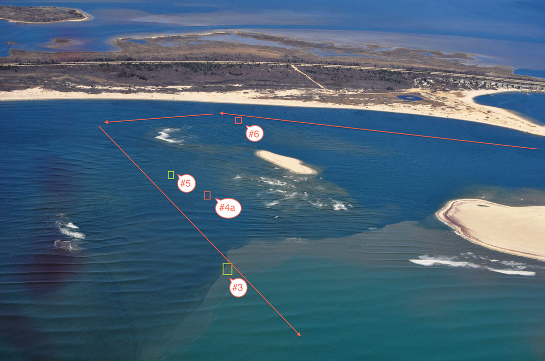
attached is a remarkable inlet photo I had taken on the 21st of April after all the dredging was completed. The buoy locations are labeled and the red arrows indicate my boats general track lines in and out of the inlet. Please share this photo as much as you'd like (websites, facebook, etc) but I only ask that you disclaimer the photo with:
"The aids to navigation in Fire Island Inlet are unreliable and all mariners must navigate at their own risk due to shallow inlet conditions. The aerial photo is courtesy of the USCG Auxiliary however, the USCG or USCG Auxiliary are not responsible for any navigational information depicted in this photo."
The rough track I marked in red gives us plenty of water, nothing really below 8 feet but as we both know that could change from week to week. We take aggressive soundings weekly and I'll keep you advised of any changes.



 RSS Feed